Introducing the Pro Upgrade for TDS GTNXi MSFS!
Upgrade now to Access Navigation Database updates from your Navigraph Subscription!
Navigraph Unlimited Subscription is required! This is not included with the Pro Upgrade.
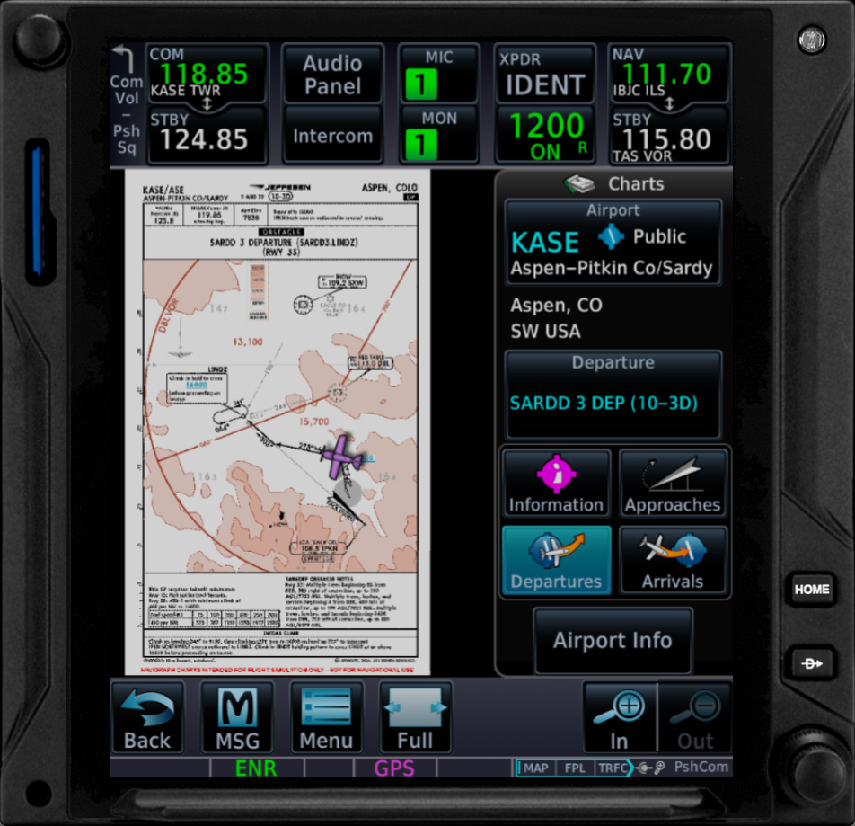
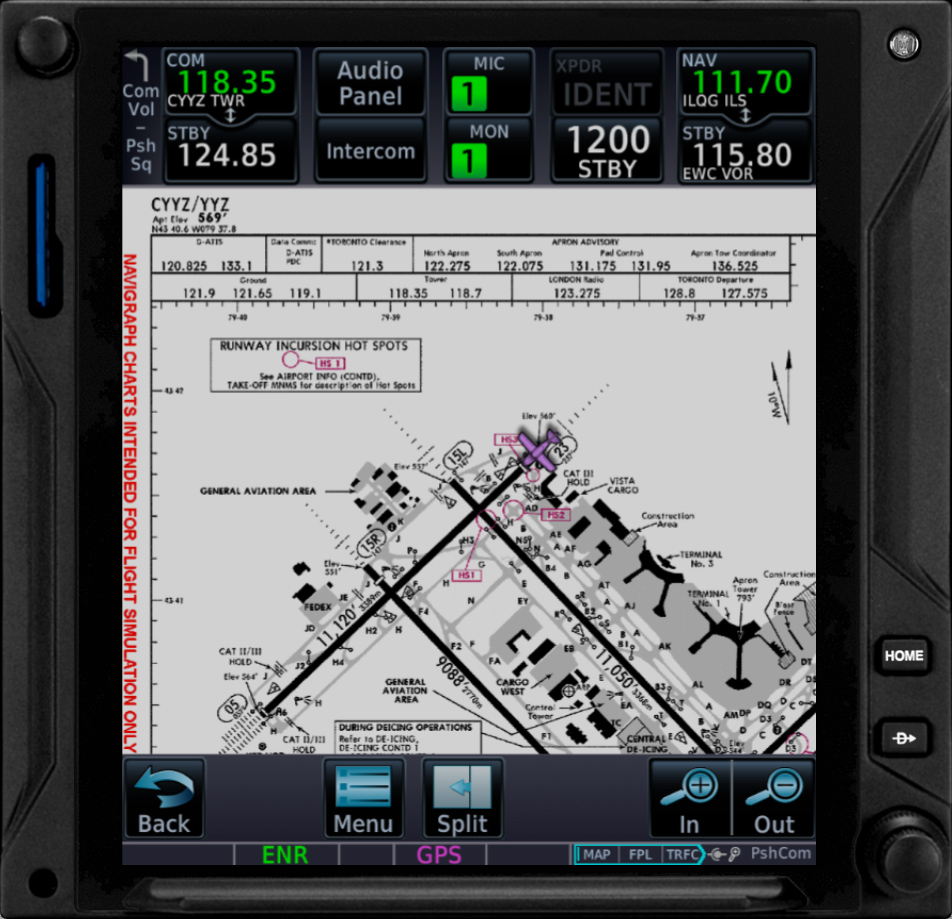
General Chart Information
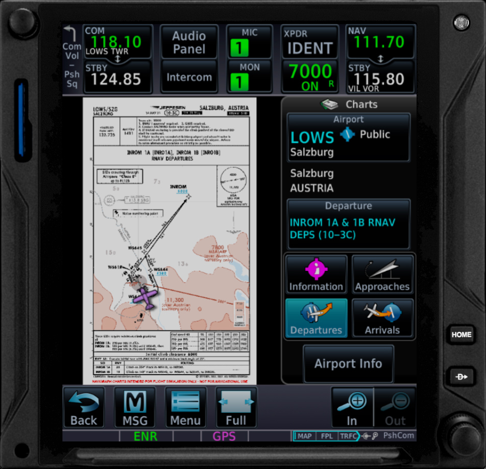
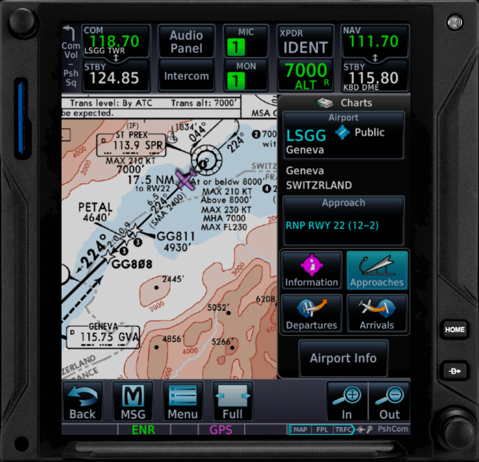
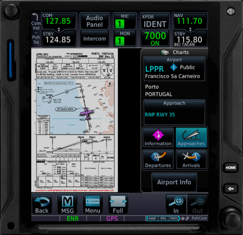
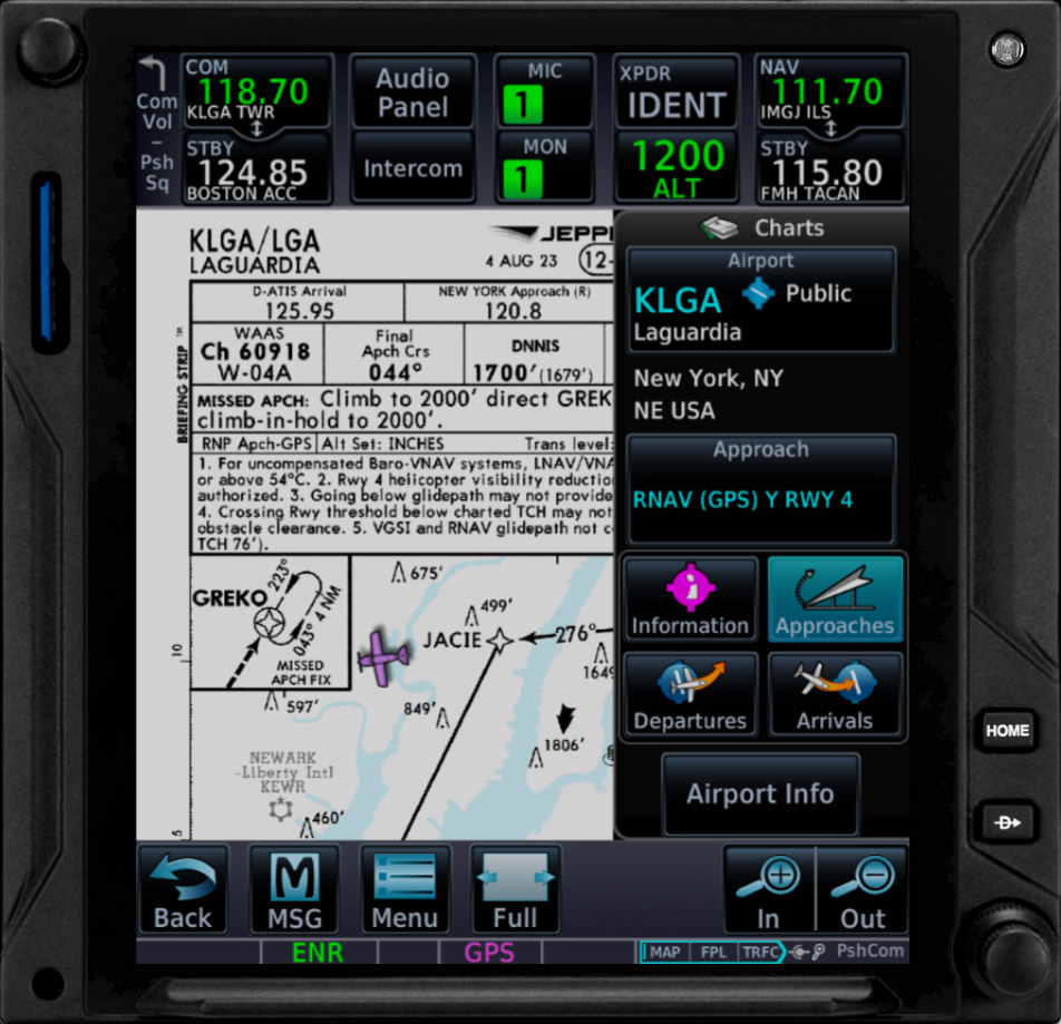
Depatures, Arrivals, Approaches and Information Chart Types
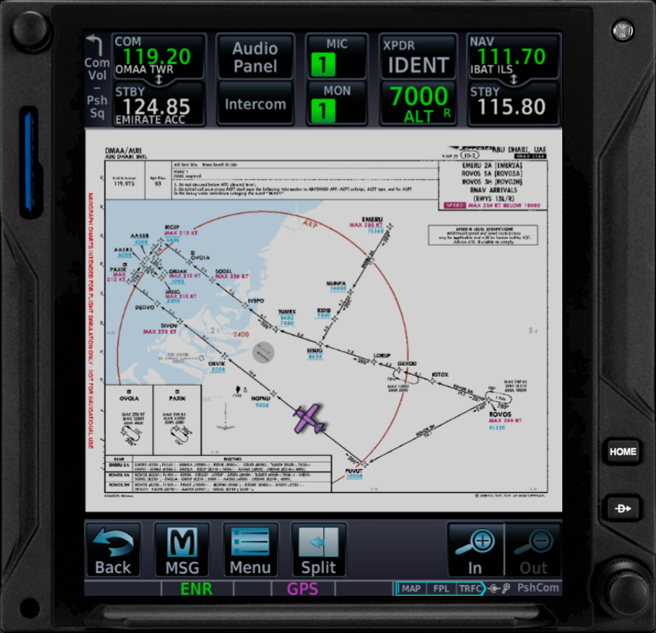
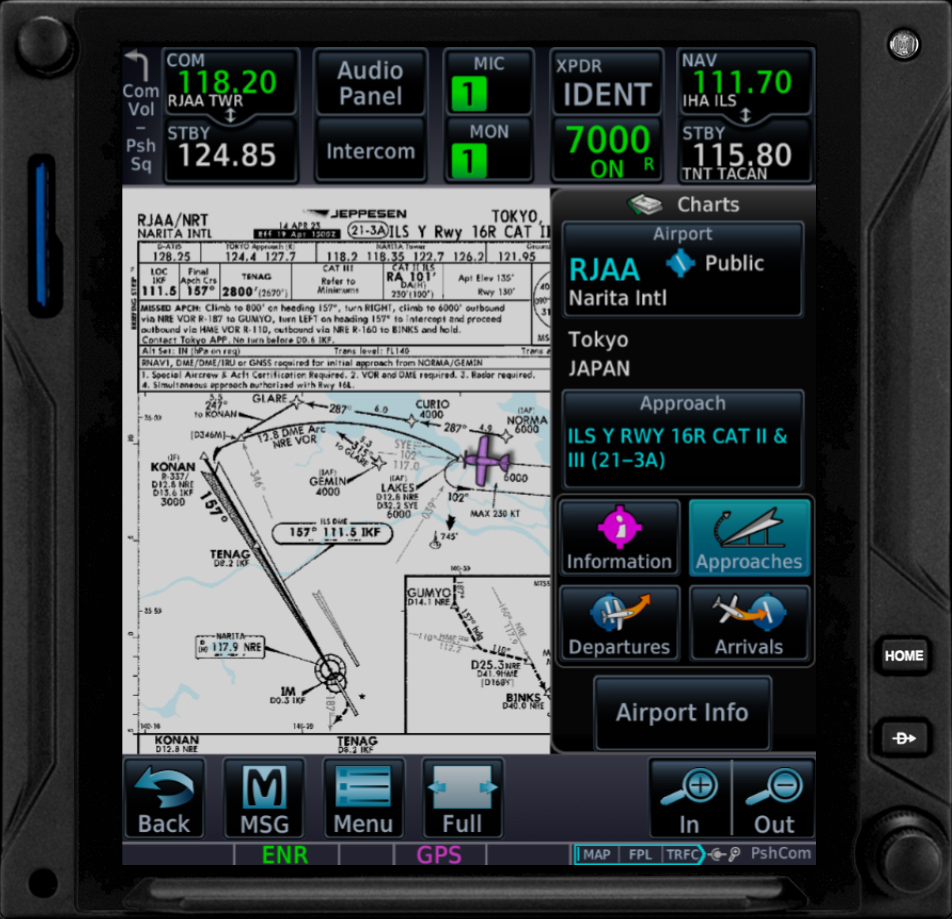
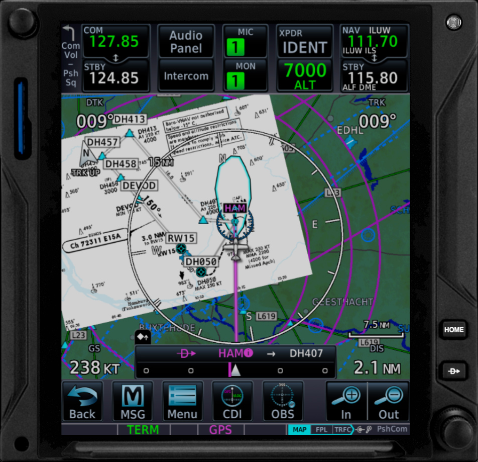
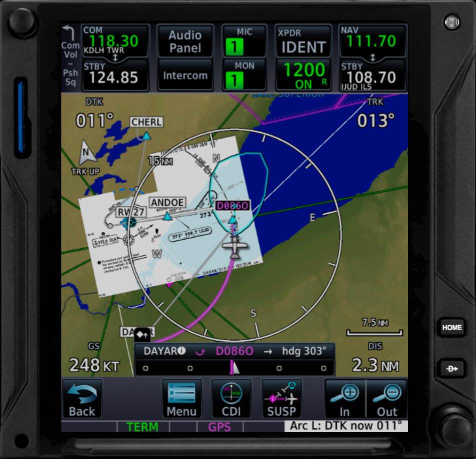
Geo-referencing, Chart insets
Map Overlay
Navigraph Support/FAQ